Home
Radar
Log in
Home
United Kingdom
Radar
Mountain
World
My account
Log in
Contact us
Search results
See all results
CAN'T FIND YOUR LOCATION?
Request the creation of a location
My location
Recent searches
Clear my history
Favorites
Edit my favorites
Create your account to save your favorites.
Log in
Weather
United Kingdom
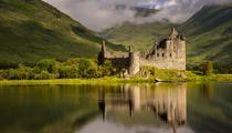
Nevis Range (ski resort)
WEATHER NEVIS RANGE
Fort William - United Kingdom
Fri
24
-
-
Sat
25
-
-
Sun
26
-
-
Mon
27
-
-
Tue
28
-
-
Wed
29
-
-
Thu
30
-
-
Fri
31
-
-
Sat
01
-
-
Sun
02
-
-
Mon
03
-
-
Tue
04
-
-
Wed
05
-
-
Thu
06
-
-
Fri
07
-
-
365
days
Day
Time / Hour
Compare
Today's Forecast
Forecast produced by
Thomas PONTHIEU
Updated at
04h45
- Next update at
10h45
(local time)
In Short
N.C.
Ski resort info
Weather radar
Hour by hour
Weather comparator
Expert’s summary
Today in Nevis Range, warning: very strong gusts.
Temperatures will vary between 12 and 15°C.
The reliability of the situation is good.
This morning
12°
Feels Like 8°
due to the wind
20 km/h
Gusts
70 km/h
Very cloudy sky turning overcast.
Risk of a few drops of rain.
Risk of rain
45 %
UV index
1
Low
Freezing level 0°
3900 m
Snow-rain limit
3600 m
Snow expected
0 cm
This afternoon
15°
Feels Like 12°
due to the wind
20 km/h
Gusts
60 km/h
Overcast sky.
Risk of a few drops of rain.
Risk of rain
35 %
UV index
2
Low
Freezing level 0°
3500 m
Snow-rain limit
3200 m
Snow expected
0 cm
This evening
13°
Feels Like 11°
due to the wind
15 km/h
Gusts
35 km/h
Overcast sky.
Drizzle clearing gradually.
Risk of rain
90 %
UV index
0
Low
Freezing level 0°
3000 m
Snow-rain limit
2700 m
Snow expected
0 cm
Night
13°
Feels Like 9°
due to the wind
15 km/h
Gusts
45 km/h
Overcast sky.
Rain starting to fall at the end of the night.
Risk of rain
90 %
Freezing level 0°
3300 m
Snow-rain limit
2950 m
Snow expected
0 cm
Tomorrow's weather
Weekend weather
Receive the weather forecast for my ski resort
Add Weather Crave to your favorite sources
Share
Link copied
Station Info
Closed
Nevis Range
Snow
N.C.
at the top (650m)
0 cm
down (100m)
Snowfall
5 months ago : 4 cm
Track Info
Lifts
0/12
Snow Parks
-/1
Nordic ski
N.C.
Back skiing
N.C.
Tracks
N.C
N.C
N.C
N.C
with
Ephemeris
Friday 24 july
Day
-4 min
Waxing
gibbous Moon
Sunrise
05h02
Sunset
21h50
Christina the Astonishing
Next few days
Tomorrow,
Saturday 25
-
|
-
-
-
km/h
Sunday 26
-
|
-
-
-
km/h
Monday 27
-
|
-
-
-
km/h
Ski resort
arround Fort William
Ski resort
Nevis Range
Near
Nevis Range
Fort William
Glen Nevis
Claggan
Inverlochy
Upper Achintore
Caol
Banavie
Achaphubuil
Corpach
Kinlochleven
Weather United Kingdom
Glasgow
Liverpool
Leeds
Birmingham
London
Portree
Coleraine
Ashford
Broadstairs
Cambridge
Westminster
Clitheroe