Today in Mirvaux, the sky will remain changeable.
Temperatures will vary between 12 and 24°C with values close to normal.
The reliability of the situation is very good.
3:00 to 6:00
11°Feels Like 10°
CalmGusts10 km/h
Clear sky.
No precipitation.
No risk of rain
This morning
12°Feels Like 10°
10 km/hGusts25 km/h
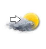
Unsettled weather becoming very cloudy.
No precipitation.
No risk of rain
UV index3Moderate
This afternoon
24°Feels Like 25°
20 km/hGusts35 km/h
Very cloudy sky with short sunny periods.
No precipitation.
No risk of rain
UV index5Moderate
This evening
21°Feels Like 22°
20 km/hGusts35 km/h
Good weather with few clouds.
No precipitation.
No risk of rain
UV index2Low
Night
14°Feels Like 13°
CalmGusts15 km/h
Good weather with few clouds.
No precipitation.
No risk of rain
Share
CLIMATE info
Rain
-90%
normal
Less rain than normal
Water restriction: Advisory
Temperature
0°C
normal
Colder than normal
Normal temperature : 18°C
Average, today :
18°C
One year ago : 18°C