Home
Radar
Log in
Home
United Kingdom
Radar
Mountain
World
My account
Log in
Contact us
Search results
See all results
CAN'T FIND YOUR LOCATION?
Request the creation of a location
My location
Recent searches
Clear my history
Favorites
Edit my favorites
Create your account to save your favorites.
Log in
Weather
Peru
Ayacucho
Huanta
Matucana Alta
WEATHER MATUCANA ALTA
Peru (Ayacucho)
Fri
24
-
-
Sat
25
-
-
Sun
26
-
-
Mon
27
-
-
Tue
28
-
-
Wed
29
-
-
Thu
30
-
-
Fri
31
-
-
Sat
01
-
-
Sun
02
-
-
Mon
03
-
-
Tue
04
-
-
Wed
05
-
-
Thu
06
-
-
Fri
07
-
-
365
days
Day
Time / Hour
Compare
Today's Forecast
Forecast produced by
Régis CRÊPET
Updated at
11h30
- Next update at
17h45
(local time)
In Short
Weather radar
Hour by hour
Weather comparator
Expert’s summary
This afternoon in Matucana Alta, Overcast skies with risk of thundery outbreaks. Possibility of showers
Temperatures will vary between 15 and 18°C.
The reliability of the situation is very good.
15:00 to 18:00
18°
Feels Like 20°
10 km/h
Gusts
20 km/h
>60 km/h
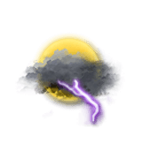
Overcast with a risk of outbreaks of thunder.
Risk of showers.
Risk of rain
45 %
UV index
3
Moderate
This evening
15°
Feels Like 15°
Calm
Gusts
15 km/h
>55 km/h
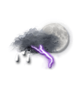
Very cloudy with a risk of outbreaks of thunder.
Gradually fading light showers.
Risk of rain
50 %
Night
14°
Feels Like 14°
Calm
Gusts
5 km/h
Very cloudy sky becoming more unsettled.
Risk of showers.
Risk of rain
30 %
Tomorrow's weather
Weekend weather
Receive the weather forecast for my town or city
Add Weather Crave to your favorite sources
Share
Link copied
Ephemeris
Friday 24 july
Day
0 min
Waxing
gibbous Moon
Sunrise
06h15
Sunset
17h48
Christina the Astonishing
Next few days
Tomorrow,
Saturday 25
-
|
-
-
-
km/h
Sunday 26
-
|
-
-
-
km/h
Monday 27
-
|
-
-
-
km/h
Near
Matucana Alta
Balsamayoc Bajo
Nueva Alianza
Nuevo Progreso
Challhuamayo
Triboline Alta
Alto Arequipa
Matucana Baja
Limonchayoc
Huamanpata
Retiro
Compania Alta
Canapampa
Weather France
Lyon
Marseille
Nice
Paris
Toulouse
Saint-Pierre-d'Oléron
Sarlat-la-Canéda
Strasbourg
Tarbes
Toulon
Toulouse
Tours