Home
Radar
Log in
Home
United Kingdom
Radar
Mountain
World
My account
Log in
Contact us
Search results
See all results
CAN'T FIND YOUR LOCATION?
Request the creation of a location
My location
Recent searches
Clear my history
Favorites
Edit my favorites
Create your account to save your favorites.
Log in
Weather
Indonesia
West Kalimantan
Setanduk
WEATHER SETANDUK
Indonesia (West Kalimantan)
Wed
15
-
-
Thu
16
-
-
Fri
17
-
-
Sat
18
-
-
Sun
19
-
-
Mon
20
-
-
Tue
21
-
-
Wed
22
-
-
Thu
23
-
-
Fri
24
-
-
Sat
25
-
-
Sun
26
-
-
Mon
27
-
-
Tue
28
-
-
Wed
29
-
-
+
Day
Time / Hour
Compare
Today's Forecast
Forecast produced by
Régis CRÊPET
Updated at
07h30
- Next update at
13h45
(local time)
In Short
Weather radar
Hour by hour
Weather comparator
Expert’s summary
This afternoon in Setanduk, Good clear periods but cloud building. Chance of light rain.
Temperatures will vary between 27 and 33°C, it will be very warm in the afternoon.
The reliability of the situation is very good.
This afternoon
33°
Feels Like 44°
due to the sun
10 km/h
Gusts
25 km/h
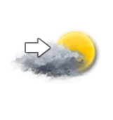
Unsettled weather becoming very cloudy.
Slight risk of showers.
Risk of rain
25 %
UV index
10
Very high
This evening
27°
Feels Like 31°
due to the humidity
10 km/h
Gusts
20 km/h
>80 km/h
Overcast with a risk of outbreaks of thunder.
Showers falling at the end of the evening.
Risk of rain
60 %
Night
26°
Feels Like 29°
due to the humidity
Calm
Gusts
10 km/h
>70 km/h
Thunderstorms developing.
A few showers.
Risk of rain
70 %
Tomorrow's weather
Weekend weather
Receive the weather forecast for my town or city
Add Weather Crave to your favorite sources
Share
Link copied
Ephemeris
Wednesday 15 july
Day
0 min
New
Moon
Sunrise
05h44
Sunset
17h55
Bonaventure
Next few days
Tomorrow,
Thursday 16
-
|
-
-
-
km/h
Friday 17
-
|
-
-
-
km/h
This weekend,
Saturday 18
-
|
-
-
-
km/h
Near
Setanduk
Rukmajaya
Pawangi
Capkala
Jahandung
Sebandut
Sungai Raya
Sei Pangkalan Ii
Sungai Keran
Serindu
Weather France
Lyon
Marseille
Nice
Paris
Toulouse
Biarritz
Blois
Bobigny
Bordeaux
Boulogne-sur-Mer
Bourg-en-Bresse
Bourges