On tomorrow in Métabief, unsettled, cold weather with some snow during the first half of the day.
Temperatures will vary between -6 and -2°C, it will be very cold in the morning.
The reliability of the situation is good.
Night
-5°Feels Like -7°due to the wind
Gusts 40 km/hNW 15 km/h
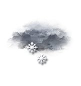
Overcast and misty. Limited visibility.
Light snow showers.
Risk of snow
80 %
Freezing level 0°
250 m
Snow-rain limit
0 m
Fresh snow
2 cm
Morning
-6°Feels Like -6°
Gusts 20 km/hCalm
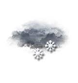
Overcast sky with a slight tendency to improvement.
Snow showers clearing later.
Risk of snow
50 %
UV index1Low
Freezing level 0°
0 m
Snow-rain limit
0 m
Fresh snow
< 1cm
Afternoon
-2°Feels Like -1°
Gusts 20 km/hSE 10 km/h
Light passing clouds that do not interfere with the sunny weather.
No precipitation.
No risk of rain
UV index1Low
Freezing level 0°
500 m
Snow-rain limit
200 m
Fresh snow
0 cm
Evening
-6°Feels Like -8°
Gusts 30 km/hSE 10 km/h
CLEAR SKY clouding over gradually.
No precipitation.
No risk of rain
Freezing level 0°
600 m
Snow-rain limit
300 m
Fresh snow
0 cm
Night
0°Feels Like -1°
Gusts 40 km/hS 10 km/h
Overcast sky.
Light rain at the end of the night.
Risk of rain
65 %
Freezing level 0°
1700 m
Snow-rain limit
1400 m
Fresh snow
0 cm
Share
Station Info
open
Métabief
Avalanche Risk
N.C.
Snow
15 cm
at the top
(1460m)
10 cm
down
(900m)
Snowfall
1 day ago : 1 cm 2 days ago : 5 cm 7 days ago : 5 cm
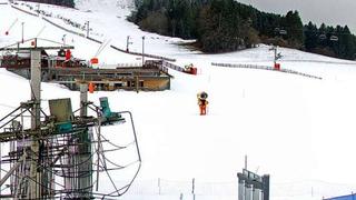
Webcam
"Métabief - Front de neige
Métabief - Front de neige
Métabief - Télésiège du Morond
Track Info
Lifts
6/12
Snow Parks
-/2
Nordic ski
0/50 km
Back skiing
Total
Open tracks
37
210
28
01
with
CLIMATE info
Rain
-70%
normal
Less rain than normal
Water restriction: No restrictions
Temperature
-3°C
normal
Colder than normal
Normal temperature : -1°C
Sunday 11:
-4°C
One year ago : -2°C