Home
Radar
Log in
Home
United Kingdom
Radar
Mountain
World
My account
Log in
Contact us
Search results
See all results
CAN'T FIND YOUR LOCATION?
Request the creation of a location
My location
Recent searches
Clear my history
Favorites
Edit my favorites
Create your account to save your favorites.
Log in
Weather
Canada
Big White (ski resort)
WEATHER BIG WHITE
Kelowna - Canada
Fri
24
-
-
Sat
25
-
-
Sun
26
-
-
Mon
27
-
-
Tue
28
-
-
Wed
29
-
-
Thu
30
-
-
Fri
31
-
-
Sat
01
-
-
Sun
02
-
-
Mon
03
-
-
Tue
04
-
-
Wed
05
-
-
Thu
06
-
-
Fri
07
-
-
365
days
Day
Time / Hour
Compare
Today's Forecast
Forecast produced by
Cyril WUEST
Updated at
17h45
- Next update at
00h00
(local time)
In Short
N.C.
Ski resort info
Weather radar
Hour by hour
Weather comparator
Expert’s summary
Tonight in Big White, Clear skies.
Temperatures will vary between 15 and 25°C.
The reliability of the situation is good.
21:00 to midnight
16°
Feels Like 15°
Calm
Gusts
10 km/h
Clear sky.
No precipitation.
No risk of rain
Freezing level 0°
4150 m
Snow-rain limit
3850 m
Snow expected
0 cm
Night
13°
Feels Like 12°
Calm
Gusts
5 km/h
Clear sky.
No precipitation.
No risk of rain
Freezing level 0°
4050 m
Snow-rain limit
3750 m
Snow expected
0 cm
Tomorrow's weather
Weekend weather
Receive the weather forecast for my ski resort
Add Weather Crave to your favorite sources
Share
Link copied
Station Info
Closed
Big White
Snow
N.C.
at the top (2319m)
N.C.
down (1508m)
Snowfall
3 months ago : 1 cm
3 months ago : 3 cm
3 months ago : 4 cm
Track Info
Lifts
0/16
Snow Parks
0/1
Nordic ski
N.C.
Back skiing
N.C.
Tracks
22
64
26
7
with
Ephemeris
Friday 24 july
Day
-3 min
Waxing
gibbous Moon
Sunrise
05h14
Sunset
20h50
Christina the Astonishing
Next few days
Tomorrow,
Saturday 25
-
|
-
-
-
km/h
Sunday 26
-
|
-
-
-
km/h
Monday 27
-
|
-
-
-
km/h
Ski resort
arround Kelowna
Ski resort
Big White
Near
Big White
Kelowna
Black Mountain
East Kelowna
South Kelowna
Rutland
Crawford
Ellison
Southridge
Kelowna Mountain
Dilworth Mountain
Lower Mission
Kettle Valley
Weather Canada
Toronto
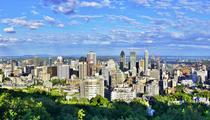
Montreal
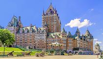
Quebec
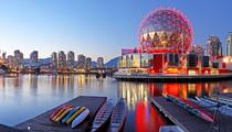
Vancouver
Winnipeg
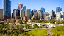
Calgary
Ottawa
Edmonton
Halifax
Kamloops
Saint John
Medicine Hat